Sunday, August 31, 2014

Training Ride 8/30: San Rafael-Marshall-Pt. Reyes Station

This was our final group training ride before taking off for the tour.  I was unsure if I should do it because I've had a cold this week.  The cold has been on the mild side, so I decided to go and cut the ride short if I didn't feel well enough.

We met at the end of Lucas Valley Road, which is actually called Smith Ranch Rd. at that part.  I hadn't done this route before.  It was also the last ride of the training season last year, but it was rained out.  However, I have been on all the roads before on various other rides with other people or groups.

Although warm already at 8 am, it was also breezy.  We took off into a head wind down Lucas Valley Road to Nicasio. Although there are some spots with no shoulder, I generally like riding on Lucas Valley Road.  There is a bit of a steep climb in this direction, but it is much gentler on the way back when tired.  After about 11.5 miles we arrive in Nicasio for a regroup.

The group taking the shorter loop went from here to Pt. Reyes Station.  The group taking the longer loop headed the opposite way on Pt. Reyes-Petaluma Rd.  I took the longer loop route, knowing that I could still cut it short if I wanted.  We had a short water stop at the Cheese Factory (Rouge et Noir) and continued to Hicks Valley Road and then on to Marshall-Petaluma Rd (toward Marshall).  These are nice country roads with little traffic.  About 3/4 of the way on the Marshall Rd you climb the Marshall Wall.  There was a nice breeze going, not the head wind we had on Lucas Valley. 

After reaching the top, there is a nice long descent all the way to the stop sign at "T" with highway 1.  Labor Day weekend with nice weather, means lots of people out at the oyster retaurants along the highway, some driving like fools.  In general, the ride on 1 was good and the view was great!

We turned off on Mesa Rd. to wind through a residential area on our way to Pt. Reyes Station.  We stopped for lunch there.  At Leticia's urging we diverged from the route sheet and did not go over to Samuel P. Taylor park but returned via Pt. Reyes-Petaluma Rd, Platform Bridge Rd. and then Nicasio Valley Rd. to get back to Lucas Valley.

Changing the route cut off about 8 miles and maybe 1,000 feet of climbing, but since I was sick, I decided that was fine.  I appreciated the shade on Lucas Valley Road since the temperature had been going up noticeably as we moved away from the coast.

I had a new accessory with me on this ride and the last one, a mirror on the handlebars.  I haven't used any kind of mirror up 'til now.  When I changed to this bike with traditional handlebars from the Bianchi with flat bar, I started thinking that it would be easier to see behind me with a mirror, so I finally got one in preparation for the tour.

John put it on for me in time for last Saturday's ride, unfortunately, it was somewhat loose and it kept slipping out of position, so I spent a lot of time looking at my arm and sometimes my thigh last weekend.  John tightened it up for this weekend, which improved things, but it still moved around on its own.  He'll tighten it up some more and see if we can get it to stay put.


Here is everyone before setting out on the ride.  Thanks to Rita for the picture.

Here's my new mirror.

Lucas Valley Road.  Thanks to Sueli for the picture.

Nicasio Volunteer Fire Department.
Stats:
64.94 miles
2,984 feet of elevation gain

Wednesday, August 27, 2014

Training Ride 8/24: Mountain biking at Redwood and Joaquin Miller parks

On Sunday, 8/24 John and I joined his friend Chris for a mountain bike ride that started in Redwood Regional Park on Skyline in Oakland.  We headed out on West Ridge Trail until we got to the crossing with the Chabot Science Center's parking lot, where we turned down, crossed Skyline and entered Joaquin Miller park. 

Unfortunately, I don't know the name of most of the trails that we take, but I can say that we went down Cinderella.  About halfway down I got indecisive about what line to take down a technical part and ended up on the ground with some scrapes.  It was a minor fall.  Most of the time my falls are preceeded by indecision.

I could feel the effects of the ride from the day before.  I didn't have any power in my legs for uphill obstacles on the trail, but my goal was not to have a great technical ride, just to get some more miles in with cardio.  Also, remember, that I count mountain biking miles double road miles.

The parks were about the most crowded that I can remember ever seeing them, especially since this was a regular Sunday and not a holiday.

Eventually, we worked our way back to Redwood.  We did a hot climb up Canyon Trail.  It has been a long time since I've been on this trail and I had forgotten how steep it is.  I tried to figure out what the elevation gain was just for this trail, but I couldn't do it.  It appears from the park trail map that it is only 0.36 of a mile, but it felt like more.  Trail map: http://www.ebparks.org/parks/redwood#trailmap.

After that, there are rolling hills all the way back to the parking lot on East Ridge Trail.  Some of these are tough, too, especially after Canyon, but not nearly as difficult.

View from the top of one of the rolling hills on East Ridge Trail.

Also East Ridge scenery.

Here's my scrapes.  Unpleasant, but no big deal.
Stats:
12.30 actual miles (not double)
1,697 feet of elevation gain

Training Ride 8/23: Big Basin

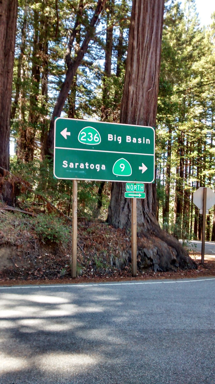
On Saturday 8/23, the Arthritis Foundation training group met in Saratoga for a challenging ride.  We started in downtown Saratoga on 4th Street.  One group headed up Big Basin Highway (also known as highway 9) for a 7 mile climb (about 2,170 feet) to Skyline Blvd. (highway 35).  Another group went by car up to Skyline to create a shorter loop with less climbing.  Both groups continued separately on Skyline for about 10 miles with rolling hills and a winding descent.

We turned right on to Bear Creek Road and followed that for about 9 miles, mostly down hill but with a few rollers thrown in, back to highway 9 in Boulder Creek.  Both groups met here for lunch.  The group on the shorter loop got back on highway 9 and continued all the way back to Skyline.  The group on the longer loop took a few back roads to get on to Big Basin Highway.  We climbed another approximately 1,000 feet over about 9 miles to arrive at the visitor center at Big Basin State Park.  The park is beautiful with some wonderful redwoods.  There were also plenty of pine trees; I could smell them throughout the afternoon.

The day was warm, but there was lots of shade as we continued up Big Basin Highway to the summit.  The road gets pretty narrow at times and we did encounter a driver who just couldn't wait another 30 seconds and had to pass us on a blind curve while we were descending.  There was another car coming around from the other direction, but fortunately there was no collision.  At the end of Big Basin Highway we returned to highway 9 to climb up to Skyline Blvd.

Although it was a beautiful ride, there was a lot of climbing, so I was happy to reach Skyline.  After crossing Skyline everything is downhill!  The seven curving miles down to the starting point are great fun to descend and luckily, perhaps due to the road construction, there was very little car traffic around me.


Group picture at the start of the ride.  Thanks to Rita for the picture.


Getting ready to get back on the road after lunch.
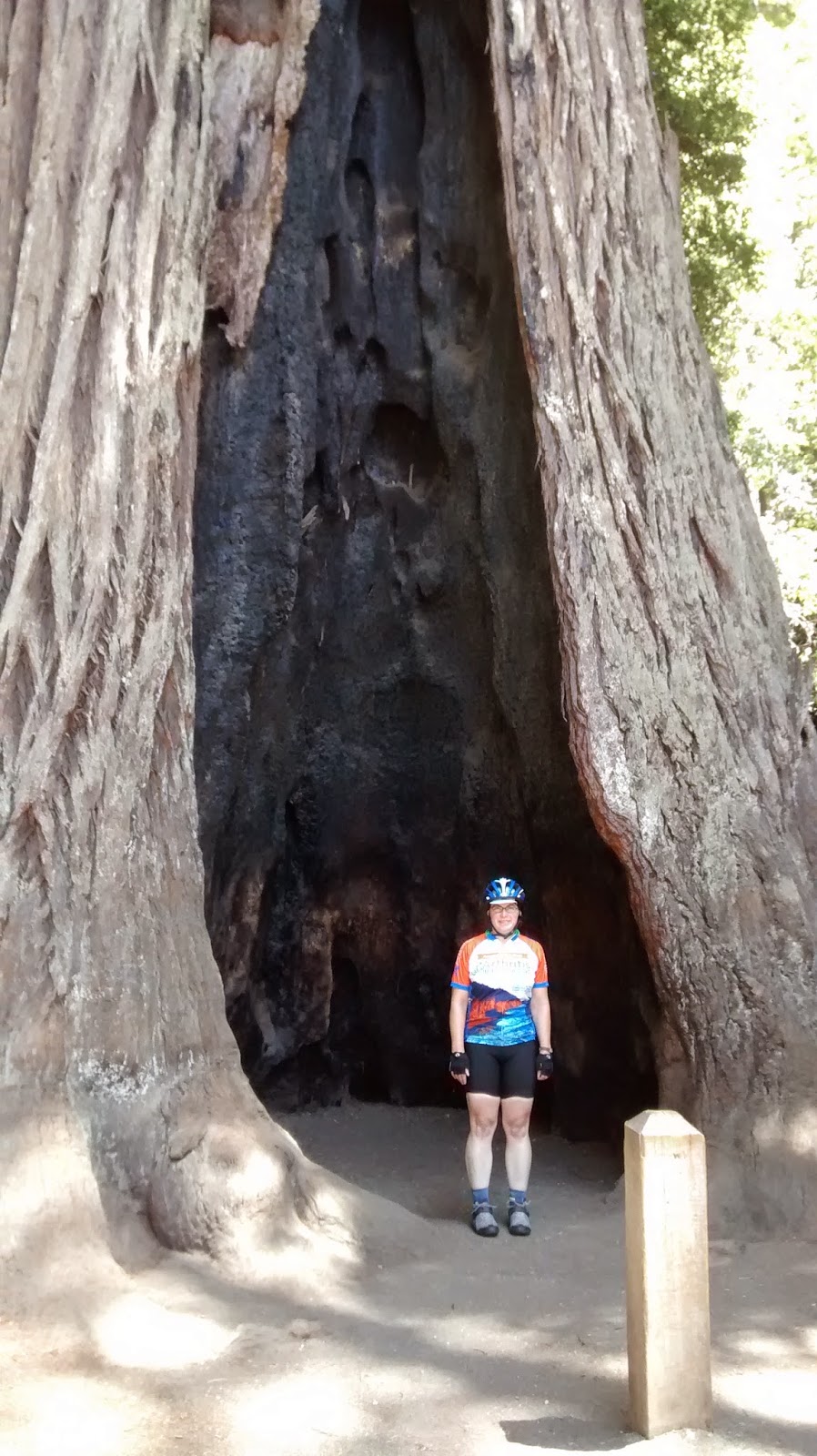
Here I am in front of one of the VERY large trees at Big Basin State park.
This picture will give a sense of the scale of the trees.  Can you see the woman standing at the tree's base?
Almost there...getting ready to get back on highway 9.

 Stats:
57.65 miles
elevation gain, take your pick:
8/23 reading: 7,506 feet
2013 reading: 6,089 feet
amount printed on cue sheet: 6,280 feet

Sunday, August 24, 2014

Training Ride 8/20: Berkeley Hills

Another evening ride, part of the Arthritis Foundation's training schedule.  Tonight, it was just me and Mary, the ride leader.  Mary is recovering from a mild knee injury, so we kept the mileage down.  We left from the usual site at Peet's Coffee at College and Alcatraz.  From there, we wound through the Rockridge streets to arrive at Tunnel Road.  The section where the bike lane moves to the left of the highway 13 traffic can be a bit dicey to negotiate, but tonight one of the cars made room for me.  A cyclist behind the wheel? 

We made the left turn and headed up Old Tunnel Road.  At the top, we kept on rolling up Grizzly Peak Blvd.  There was a lot of fog blowing around and condensation was dripping off the trees.  We made a stop at the steam trains parking lot to put on more layers and turn on our lights.  I was so happy to have packed the full-fingered gloves as well as arm and leg warmers.  We had a quick chat with a couple of mountain bikers, also putting on layers, about when the old Berkeley Bowl supermarket opened.  When was that?

We returned to the road and then headed down Golf Club Road by the Tilden park golf course to get over to Wildcat Drive.  We continued down to San Pablo Dam Road and went east to the Orinda BART station. My hands were freezing after so much descending.

We rode BART back one stop to Rockridge.  From there I rode my bike back to the car a few blocks away.  I warmed up a little on BART, but by the time we were back in Oakland my fingers were numb again.  I was envisioning having a cup of hot chocolate when I got home. 

Only in the Bay Area could it be so cold in August.

A foggy night in Berkeley.  It was blowing in in drifts.  This picture doesn't do it justice.
Stats:
19.82 miles
2,257 feet of elevation gain

Tuesday, August 19, 2014

Training Ride 8/17: GPC Mid-August Birthday Ride

On Sunday, 8/17, my training ride was a Grizzly Peak Cyclist club ride celebrating a couple of August birthdays, Sherie and Kurt.  Sherie is the club president.  She also selected the route.

We started in Half Moon Bay with overcast skies and drizzle.  I had the arm and leg warmers on.  The first ~20 miles were heading south on highway 1 to the Pigeon Point Lighthouse.  There were some very large rollers on the way.  We regrouped at the lighthouse and then continued on a little way further on highway 1 before turning onto Gazos Creek Rd.  We headed up a spur that passed some lovely territory.  It ended at a gate with a dirt road on the other side.  It was definitely time for me to take off the arm and leg warmers by that time.  We returned, headed up Cloverdale and rode for a while before turning on Butano Cutoff and then over to Pescadero for lunch at Arcangeli's.

Arcangeli's grocery is the home of the very tasty garlic and artichoke bread.  They bake it fresh throughout the day.  In addition to a sandwich for lunch, I got a loaf of the famous bread.  I have a large bike bag and was able to cram one of smaller loaves in there.  Probably that bag will smell like garlic for some time to come.  Thanks to Phil who passed around a delicious olallieberry pie, still warm from the oven at a place across the street, to all interested Grizzlies around the picnic tables.  Some people said it was better than Fat Apple's pie.  I think I'll have to have a slice of theirs to adequately reach a conclusion.

After lunch was Stage Road.  It starts out all sweet and friendly, with new pavement, but the new pavement ends and the rolling hills and then climbing come in.  At the top of Stage, we went north on highway 1 a short distance to get to Tunitas Creek Road.  We had a break at the Bike Hut and then moved on.

Unfortunately, I misinterpreted the cue sheet and turned left on Lobitos Creek Cutoff instead of Lobitos Creek Rd.  It only cut off about 5 miles but quite a few feet of climbing.  Here's how Sherie described it: "The climb up to the farms on the ridge-line offers a challenging but peaceful gradient, spectacular views all around the hillsides and back out to the ocean...(think something like somewhere between Tunitas Creek, Old La Honda Road and the top of Coleman Valley Road)...and then a zippy, fun descent down to where it joins Verde Road.... about as fun as a bicycle ride can get!!"  Oh well, next time.

Lobitos Creek Cutoff did rejoin the route without any difficulty.  We continued on Verde Rd., Purisima Creek Rd., and then a climb near the end on Higgins Canyon Rd.  After the climb, there was a nice descent and we were back by the firehouse on Main Street in Half Moon Bay.

Pigeon Point Lighthouse.

End of Gazos Creek Road.

Not the best picture, but the best I could do to show the picnic area at Arcangeli's.  This was after we sang Happy Birthday.
Flowers at the Bike Hut.
 Stats:
61.05 miles
3,761 feet of elevation gain
1 loaf of bread, mildly flattened, but still gooood.


Sunday, August 17, 2014

Training Ride 8/16: Peninsula with Sueli

I decided to do a shorter ride today because I'll be doing a longer ride with a fair amount of climbing on Sunday.  I met a friend from the Arthrtis Foundation training group, Sueli, and did one of her standard routes.  We left Canada Road near highway 92 and headed all the way down it and into Woodside.  We continued into Portola Valley.  From there we headed up Alpine for a climb and then returned the way we came.

On Canada road, we happened to meet up with another Arthritis Foundation training group member, Leticia.  She was also doing a short ride as a warm up to the metric century she would do on Sunday, Tour of Napa Valley.


Leticia, me and Rick at a short rest stop.  Sueli is taking the picture.

Pao de queijo, Brazilian cheese bread baked fresh by Sueli.  We had these with our lunch after the ride.
Stats:
31.54 miles
1,519 feet of elevation

What is the route for the People's Coast Classic Bike Tour? UPDATED 9/4

Day 00:  Us Bay Area participants are taking a chartered bus up to Oregon.  We leave early in the morning on Friday, September 5.  We will arrive in Astoria in the early evening.  We'll be in a hotel for the night.

Day 0: Saturday, September 6.  We'll be able to explore Astoria, in the north of Oregon, during the day.  In the evening will be a kick-off dinner.  Camping begins.

Day 1:  Sunday, September 7.  We hit the road!  Astoria to Tillamook, 68 miles.  You may have heard of Tillamook because of their cheese.  You can find it in local supermarkets.  We will go through Seaside,  Cannon Beach, Manzanita, Nehalem, and Garibaldi.  Afternoon tasting at Tillamook Cheese Factory!
Here is a "Map my Ride" link to see more detail about the route we will take, including a chart of the elevation gain.  There is one for each day of the tour provided by Brian Simard, the marketing manager/graphic designer for the Great West Region of the Arthritis Foundation.  http://www.mapmyride.com/routes/view/472777062

Day 2:  Monday, September 8.  Tillamook to Otter Rock, 72 miles and four major climbs.  We'll ride on the Three Capes Scenic Route through Dunes of Sandlake and Pacific City.  http://www.mapmyride.com/routes/view/523079918

Day 3: Tuesday, September 9.  Otter Rock to Yachats, 32 miles.  A sort-of rest day.  2-day riders will be departing the tour and 4-day riders will be joining us.  6-day riders, like me, will have the morning free to explore.  http://www.mapmyride.com/routes/view/482079682

Day 4:  Wednesday, September 10.  Yachats to Lakeside, 60 miles.  We'll go though Florence and Winchester Bay.  http://www.mapmyride.com/routes/view/501869944

Day 5:  Thursday, September 11. Lakeside to Port Orford, 72 miles.  We will ride through Bandon (Oregon's cranberry capital).  http://www.mapmyride.com/routes/view/501877302

Day 6:  Friday, September 12.  Port Orford to Brookings, 57 miles.  We will be going through Gold Beach.  Finish line party in Brookings, which is about 6 miles north of the California border, at about noon. http://www.mapmyride.com/routes/view/501882320

 Immediately following the finish line party, we take the bus back to the Bay Area  for a night time arrival.

"Day 7:"  Sleep in, pet the dog, get some laundry done, and go through the stacked up mail.

Thursday, August 14, 2014

8/13 Training Ride: Old Tunnel & Grizzly Peak

Now that summer break is over and I am back to work, my Wednesday training rides have moved to the evening.  The Arthritis Foundation's training group will ride every Wednesday until the tour and then go on hiatus.

On 8/13, it was just me and Mary, the ride leader.  One of the ligaments in Mary's knee wasn't feeling so good, so we kept the mileage down.  We left from the usual site at Peet's Coffee at College and Alcatraz.  From there, we wound through the Rockridge streets to arrive at Tunnel Road.  The section where the bike lane moves to the left of the highway 13 traffic can be a bit dicey to negotiate, but it was not hair-raising today.  We made the left turn and headed up Old Tunnel Road.  There were lots of other cyclists on the road, too.

When climbing Old Tunnel, we always meet up at the intersection of Skyline and Grizzly Peak (Old Tunnel becomes Skyline at Broadway).  I arrived first and decided to just go up the road a short bit to Sibley regional park to get some more water.  Sadly, I missed Mary in that short time and she continued up Grizzly Peak Blvd, thinking that I had gone ahead.  I returned to the meeting spot not realizing Mary had just been by.

It took quite a while of circling around and a cell phone call that finally got a signal and went through to find out that Mary was about 5 miles ahead of me by that time at Grizzly Peak and Centennial by that time!  Mary, always so nice, waited for me to catch up.  Fortunately, there were no more mishaps the rest of the evening.  The fog was coming in, so I put on the leg and arm warmers and turned on the lights.

We headed down (mostly) Golf Club by the Tilden park golf course and over to Wildcat Drive.  We continued down to San Pablo Dam Road and then over to the Orinda BART station. 

We rode BART back one stop and exited at Rockridge.  From there I rode my bike back to the car a few blocks away.

Here we are at the Orinda BART station.  Thanks to a friendly BART user who took our picture.  We've got the People's Coast Classic jerseys on.  Only a few weeks to go!

Stats:
21.05 miles
2,167 feet of elevation gain

Saturday, August 9, 2014

Training Ride 8/9: Monthly Grizzly Peak Cyclists "Allegretto" Route

For my training ride today, 8/9, I joined the monthly Grizzly Peak Cyclists group ride.  There are various groups that go a variety of distances and speeds.  I joined the "Allegretto" group, which is the middle group.  All groups started together in the cold and wind at the Orinda BART station.  From there we headed down San Pablo Dam Road/Camino Pablo.  Fortunately, the sun came out here and stayed out, but didn't get too hot.  We took Castro Ranch Road and then Alhambra Valley Road.  My group continued over Pig Farm Hill to Reliez Valley Road.  We had a break at a golf course off Grayson.  We continued on Reliz and then took a number of streets and in Walnut Creek got on Danville Blvd.  This road changes its name a number of times.  We stopped for lunch just before the intersection with Norris Canyon at Diablo Deli.  By then, I think it was San Ramon Blvd.

After lunch we went around the corner to Norris Canyon and then on to Crow Canyon.  Crow Canyon Road doesn't have that much shoulder, no bike lane, and a lot of car traffic going very fast.  It was good we didn't spend too much time there.  We moved on to Cull Canyon and then Hayer to take us to Castro Valley.  We turned up Redwood Road and did a little climbing before a second break at another golf course.  We continued up Redwood for a classic cyclist climb.  At the split, we went up a little further on Pinehurst before a fun descent.

In Moraga we took some side streets to avoid some of the traffic, but returned to Camino Pablo to head back to the BART station.  By then the wind was up and the fog was returning.

I didn't do a very good job of taking pictures.  I was pretty busy just trying to keep up!  Here's me at the end.  No before picture, just after.

This is the jersey the Arthritis Foundation as sent me.  All participants will wear it on the first and last day of the tour.
Stats:
64.47 miles
4.079 feet of elevation gain

Thursday, August 7, 2014

Training Ride 8/6: Valley Ford to Duncans Mills

8/6 (Wed).  This was my last Wednesday ride with the Grizzlies for a long while.  We started in the small town of Valley Ford in Sonoma County, just off highway 1.  Despite being kind of far, there was a large group of riders, about 30.  We took Valley Ford Freestone Rd, to Bodega Rd, to the Bohemian Highway.  I really like the Bohemian Highway.  In Monte Rio we went left on 116 and took Austin Creek Rd. in Cazadero as a sort of scenic extra. We returned to 116 and continued west on that until we reached Duncans Mills.  We stopped at a bakery for lunch. Following lunch, we continued on 116 to Jenner.  A handful of us took a short detour (north on highway 1) to see the mouth of the Russian River.  There were some seals in the distance.  Fog was drifting around, but it was a humid day, so not too cool.  We returned south on highway 1. Shortly before Valley Ford is Bodega Bay, Bob and I stopped to see the bell tower which is just off the highway (picture and description below). After that short break we continued on 1. This section of highway 1 has rolling hills with a few larger hills at the end nearing Valley Ford. The territory was great, but there were a lot of crunchy roads in need of repaving.

"Dog Love" totem on Austen Creek Road in Cazadero.

At Duncans Mills.


I wasn't exactly ready for the picture, but there I am at the mouth of the Russian River.
The Children's Bell Tower.  The bell tower in Bodega Bay.  It is a memorial to a young boy, Nicholas Green, from the area who was tragically killed while on a trip with his family in Italy.  His parents donated his organs, which was very controversial in Italy at the time, 1994.  The bells were donated, almost all by families, churches and schools to express their sorrow over what happened and their appreciation for Nicholas's parents decision to donate his organs to seven Italians.

 Stats:
52.20 miles
1,917 feet of elevation gain

GPC Novice Ride Series, Ride #1


8/2 & 8/3 (Sat & Sun)  Alameda Creek Trail.  The Grizzly Peak Cyclists offer a novice ride series.  This was the first in the series.  John and I did a pre-ride on Saturday so I would be familiar with the route and I did the official ride as a ride leader with the group on Sunday.  It was a nice ride both times.  It starts and ends at the Union City BART station.  It is only about a mile up Decoto Road to the trail entrance.  We rode from there to the end of the trail.  From there we retraced our path and then went up a little hill on to the Bayview Trail.  We went around the bay side of the path and arrived at the Coyote Hills visitor center.  We continued a little further and then rejoined the Alameda Creek trail and retraced our path back.  On Saturday after the ride John and I went the the Bombay Pizza Co., "home of the curry pizza" and on Sunday the group went to Mr. Kabob.  Both are good places.  There were lots of good views on this ride.  
View of the bay from trail.


Sheep on the hill side, clearing brush.

Close up sheep.
Curry pizza.

Stats:
20.23 miles
146 feet of elevation gain

Are those all the training rides, part 2

In the previous post, I answered the question "Are those all the training rides?"  The answer is no.  Except for one training ride entry I had been only posting the training rides I had pictures for.  However, I've been trying to get in 130 miles a week, with two of the riding days back to back (to make it more like the 6 day tour).  So, there are more rides, including mountain bike rides.  My part one post listed the additional training rides in June that didn't have pictures.

Here's the July rides without pictures.

7/2 (Wed) Grizzly Peak Wednesday ride: Sort of South Loop of Grizzly Peak Century.  This ride covers some territory of the south loop (afternoon) route of the annual Grizzly Peak Century.  It starts and ends at Lake Temescal rather than Orinda.  We used Old Tunnel to get to Skyline.  Down Skyline and through a corner of the Oakland zoo property. Lunch stop on Foothill Blvd. From there we climbed Lake Chabot Rd., went through Castro Valley to Redwood Rd. Up Redwood to Skyline. Down Butters and the bike trail to get back to Temescal. Stats: 40.56 miles and 3,729 feet of elevation gain.

7/5 (Sat) Mountain biking at Annadel State Park in Santa Rosa.  Santa Rosa is a long way to go for a bike ride, so we usually so a long loop.  This route was just about our normal loop, but we cut out just a bit at the end because I wanted to be sure we got done in time to get the fish tacos at Lepe's.  Last time we were out there, they were closed when we arrived!  I love those tacos!  The reason for the time concern was that we started late to avoid the worst of the afternoon temps.  Annadel is quite rocky and challenging.  This was every bit as much as a training ride as any long, climb-y road ride.  20.62 miles and 2,450 feet of elevation gain.

7/9 (Wed) San Rafael to Bovine Bakery via Samuel P. Taylor State Park, Marin County.  GPC Wednesday ride.  For this ride, we started at Miller Creek Road and Lucas Valley Road at the community center.  It was a warm day in San Rafael.  We headed down Lucas Valley Road and then took Sir Francis Drake, which goes through Samuel P. Taylor park.  My first time here.  There is a paved multiuse trail through the park.  I was happy to have someone with me to show me the way.  It was cool and foggy at SPT.  We emerged back on to Drake, went over the Olema hill and then took Bear Valley before heading back to highway 1 to go to the bakery in Pt. Reyes Station.  Can you tell by now that GPC likes that place?  Return through Nicasio to San Rafael.  Lucas Valley Road is a beautiful stretch and less climbing on the return.  46.93 miles and 2,300 feet of elevation gain.

7/13 (Sun) I started this ride right from my front door and headed out to San Pablo Dam Rd., over the Three Bears (Bear Creek Rd.). That returned me to SPDR where I continued out to Moraga. From there I went through Canyon and up Pinehurst. At the top I turned on to Skyline to Grizzly Peak. At Spruce I headed down through Kensington to home. 46.74 miles and 3,661 feet of elevation gain.

7/16 (Wed).  My friend Debra and I decided to ride up Mines Road.  The forecast was for considerably lower temperatures in Livermore than usual in July and I had never been there, so we decided to do it.  We met at Robertson Park in Livermore, then headed out on S. Livermore/Tesla to Mines Road. It was 30 miles from the park up to The Junction where we stopped for lunch. Most of the climbing on this ride was before lunch.  Despite being cooler than usual, it was still pretty warm.  There was some good cloud cover early in the ride.  The Junction is a bar/restaurant but its closed on Wednesdays.  We figured no one would mind if we ate at the picnic tables outside.  There was a guy inside working.  He came out and I thought he'd tell us to leave, but instead he turned out to be an owner and asked us if we wanted some water.  I really did need more water, so it was a good thing.  We returned the way we came.  We'll save this ride for late fall, winter and early spring.  59.48 miles and 3,978 feet of elevation gain.

7/27 (Sun) Mountain bike ride at Tamarancho in Fairfax.  John and I did our usual route starting from the Marin open space trailhead near White Hill School. I was super happy not to wipe out going down the ravine, like I usually do.  Now I just have to learn how to make it up the other side.  It was pretty warm, but not too bad.  Good eats afterward at the Iron Springs Brewery.  14.51 miles and 2061 feet of elevation gain.


Tuesday, August 5, 2014

Are those all the training rides?

"Are those all the training rides?"  The answer is no.  Except for one training ride entry here, I've only posted the training rides I had pictures for.  However, I've been trying to get in 130 miles a week, with two of the riding days back to back (to make it more like the 6 day tour).  So, there are more rides, including mountain bike rides.

Here's a summary of the other rides for June:

6/22 (Sunday) Old Tunnel-Pinehurst-Wildcat
This is one of the routes that the Arthritis Foundation training group does on Wednesday nights except that I started and ended it from my house in El Cerrito rather than the Peet's on Alcatraz and College.  I was showing Leo the local roads.  He's a cyclist new to the area.  We go through city streets to get on to Old Tunnel from Ashby Avenue.  Old Tunnel changes its name to Skyline at Broadway.  We bypassed Grizzly Peak and continued down Skyline to Pinehurst and took that down to Moraga.  San Pablo Dam Road brought us to Wildcat Drive.  There's some pretty good climbing from there up to Inspiration Point where we took a break.  From there it is mostly rolling or downhill back to the house (through Kensington).
33.72 miles and 2,616 feet of elevation gain.  The Mt. Tam ride as the day before.

6/25 (Wednesday) Old Tunnel-Grizzly Peak
I joined the Arthritis Foundation for their Wednesday night ride.  I started and ended at home, so I changed the end of the ride rather than returning to Peet's.  This is the 20 mile option for the Wed night group.  They took Wildcat Drive down to SPDR and ended at the Orinda BART station to go back to Peet's.  I peeled off and went down Spruce and then residential streets in Kensington too numerous to list to go home.
21.42 miles and 1,903 feet of elevation gain.

6/28 (Sat) Recreational Mountain Bike Ride at China Camp with the California Deaf Wheelers.  This was a front side loop of China Camp State Park in San Rafael.  This was a good warm up since I haven't been on a mountain bike in months.

6/29 (Sun) Mountain bike ride at El Corte de Madera (AKA Skeggs Point) in Woodside, or close to it.  A more challenging mountain bike ride with John and his friends.  We took a lot of trails I didn't know the name of.  The temperature was warm, but we started around 3 pm, so the temp started going down not too long after we got started and there was thankfully plenty of shade.  The climbing , esp. the long climb at the end went really well for me!  Had a yummy sushi dinner in San Mateo (I think) on the way home.
My computer said it was only 10.91 miles, but Chris's said 14.something, so I'll take the higher one.  In this case, I think that is more accurate.  2,432 feet of elevation gain.  My personal opinion is that mountain bike miles should count for double the same number of road miles due to the obstacles on the trails.


Training Ride 7/31: Nicasio to the Lighthouse and back

On July 31 I joined the Duros West group of Grizzly Peak Cyclists on their weekly Thursday ride.  Thanks to Mark for the ride to Nicasio.  We started in the small town of Nicasio in Marin County.  We headed out on Nicasio Valley Road and then west on the Point Reyes-Petaluma Road, going around the reservoir.  Like with the route to Drake's Beach, we continued on Platform Bridge Road and then on to Sir Francis Drake Blvd. over the hill to Olema.  We took Bear Valley to avoid traffic and then met up again with Drake. 

We stopped for a while in Inverness Park at Perry's deli to get sandwiches for lunch later.  My sandwich, by the way, was fabulous!

We continued on Drake almost to the beach, but instead of going straight you go to the right over rolling hills to the light house.  Lots of historic farms along the way and some very bumpy cattle grates. 

Despite being a Thursday, it was fairly crowded at the lighthouse.  It must be people on summer vacation.  We rode all the way to the visitor center and then ate lunch at the picnic table "overlooking" the lighthouse.  The fog was pretty heavy and we only got some occasional glimpses of the lighthouse.  It was somewhat windy, but not too bad.

On the way back, we saw some elk in the distance.

We reversed course to return, but detoured through Point Reyes Station to stop at Bovine Bakery.  I was still full from lunch, but took my treat to go.  Shelly got buffalo milk gelato at Toby's Feedbarn and Coffee Bar.  It is the same milk local cheese makers are making buffalo mozzarella.  He says the herd is at a ranch along the Pt. Reyes-Petaluma Road.

We returned to Nicasio via Pt. Reyes-Petaluma Road and Nicasio Valley Road.  I was happy to get out of the saddle.

It was a nice day out and pleasant temperature overall.  I even had a quick nap on the way back since I wasn't driving!

This little shrine is just at the end of the parking lot for Perry's deli in Inverness Park.

I only got a moment to snap this picture of the ocean at the lighthouse before the fog came back.  Yup, that's my finger.  I wasn't able to take a better photo due to the fog.
Stats:
62.99 miles
3,245 feet elevation gain

Training Ride 7/30: Temescal-Orinda-Pinehurst

On July 30 I joined the Grizzly Peak Cyclists weekly Wednesday ride.  This ride was to celebrate the repaving of Wildcat Drive.  As one friend said, "the wild cat has turned into a kitten."  The road was in terrible condition and cyclists had to be very careful on it.  Now it is so smooooth.

We started at Lake Temescal in Oakland and headed up Old Tunnel Road and then took Grizzly Peak to Wildcat.  What a difference to be on a good road!  We followed Wildcat with a break at the Island picnic area.  Despite being a Wednesday morning, there was a party going on there with a lot of BBQing and music.  Too bad we weren't invited.

We continued through Tilden Park on Wildcat until we arrived at San Pablo Dam Road.  We took a right on SPDR and continued to Orinda where we had lunch.  I met a former Grizzly Peak Cyclist who now lives in Oregon.  He gave me some information about what kind of weather and temperatures to expect on the Oregon coast in early September.

After lunch, we continued on SPDR which becomes Camino Pablo.  We took Moraga Road to Pinehurst where we rode through the town of Canyon on rolling hills.  After leaving the town, no more rolling, just climbing up to Skyline Blvd.

There was a brief regroup and then we continued on Skyline back to Old Tunnel Road and reversed our morning route to Lake Temescal.


That's me in the front riding on Grizzly Peak Blvd.  Photo by Nancy Yu, a member of Grizzly Peak Cyclists who has her own blog.

There's the equipment that fixed the road.  They still need to do the striping and all, but it was great.
At theater square in Orinda for lunch.
Stats:
36.33 miles
3,014 feet of elevation gain

Pedalfest

This doesn't have to do with my training, but I did go over to Pedalfest after my 7/26 ride to check it out.  It is a yearly event focused on bicycles.  There were some interesting booths and vendors, and activities, include a stage where the bands were powered by stationary cycles that the audience pedaled.

Here's some photos:

"El Cerrito Racing," I couldn't resist.  The high school mountain biking team had a booth with an obstacle course to ride.

A crazy bike meant to look like two old fashioned penny farthing bicycles.  In the background, you can see the bikes mounted on the light poles.
Check out the Pedalfest website: http://pedalfestjacklondon.com/

Training ride 7/26: Two Bridges in Reverse

On Saturday 7/26 I joined a Grizzly Peak Cyclist ride that started at the Pleasant Hill BART station.  It was predicted to be quite hot, so I was glad to start in Pleasant Hill and then move on to parts closer to the bay.  It was surprisingly hot at 9 am!

We left the station and got on Alhambra Avenue, which we took all the way to downtown Martinez for a Starbuck's stop.  We continued from there to get on to the Benicia bridge.  It was uphill most of the way across the bridge with a pretty good head wind.  We continued through Benicia making our way into Vallejo. 

There was a misprint on the cue sheet, so I went the wrong way on Sonoma Blvd, but it wasn't very far.  Unfortunately, as I was getting back on to the ride route I got a flat tire.  Not sure what it was, but it made a noticeable albeit small cut in my brand new tire!  A number of members from our group came along moments later and kept me company while I changed the tube.  We carried on across the Carquinez bridge and had lunch at a deli. 

After lunch we took Carquinez Road to Cummings Skyway.  By now, the temperature had gone up noticeably.  The climb wasn't very steep, but it was fairly warm.  We had a nice long descent down Franklin Canyon.  We regrouped at the intersection with Alhambra Avenue.

The rest of the group continued a short way back to the BART station.  To get more training miles in, I went to Alhambra Valley Road, over Pig Farm Hill, Castro Ranch Rd., and then San Pablo Dam Road.  I continued home from there.  Alhambra Valley Road was the hottest part of the ride, but I could feel the cooling breezes start on the other side of Pig Farm Hill.  I had been thinking of ice cream, but by the time I got home, it was so cool that I didn't feel the need for it any more.

Hmmm, I don't seem to have any pictures of this one.  In case you are wondering, I have not posted the training rides without pictures (until now).

Stats:
64.49 miles
3,378 feet of elevation gain

Friday, August 1, 2014

Training Ride: 7/23 Nicasio to Drakes Beach

On July 23 I rode with the Grizzly Peak Cyclists' Wednesday group from Nicasio to Drakes Beach.  While off duty for the summer, I've been riding regularly with this group.  They are very friendly.  If you are free on a Wednesday, drop in and join them.

It was a humid day with some rain while I drove to the starting point.  Shortly after turning off Nicasio Valley Road and on to Point Reyes-Petaluma Road we got some drizzle and then some rain.  Fortunately, it was brief, but the humidity stayed all day.  We took the Platform Bridge Road to Olema and then on to Bear Valley Road to get to Sir Francis Drake Blvd.

We rode through all the towns on Sir Francis Drake to the end of the road.  Saw some elk in the distance as I approached Drakes Beach.  It was surprisingly warm and wind free at the beach.  Also, some really good restrooms there; much better than at most public beaches!

We ate our lunches at the picnic tables and watched the waves. 

Following lunch we retraced our route through Inverness Park, then turned on to highway 1 to stop at the Bovine Bakery in Point Reyes Station.  After a break for some baked goods, we left town and got on the Point Reyes-Petaluma Road to return to Nicasio.

Bikes at the beach.

Lunch break at the picnic tables.
Stats:
54.33 miles
2,324 feet of elevation gain

Training Ride: 7/19 Old La Honda Road to Tunitas Creek via Pescadero

On July 19, the Arthritis Foundation had a training ride that covered some classic cycling territory.  We began on Canada Road, just off highway 92.  There were different length loops available.  Four of us took the long route.  We rode Canada Road into Woodside.  If I get rich one day, I might like to live here!  We made our way to the climb up Old La Honda Road.  Although it was a warm day, the road was mostly shaded.  Lots of folks were out riding up the road as well.  After reaching the top, we continued across Skyline and down the other side.  Nice to have a fabulous decent after all that climbing. 

We took 84 briefly to get to Pescadero Road.  I've never been on that road and found there were was some bonus climbing here that I hadn't expected.  Beautiful terrain.  We made a water stop at a state park after the climbing and continued to Stage Road.  We stopped in Pecadero at Arcangeli Grocery for sandwiches we arrived just before the crowds, so we got a nice picnic table in the back.

After a good lunch, we took on the rolling hills of Stage Road to highway 1.  It was just a short distance on the highway and then we turned on to Tunitas Creek, the last major climb of the ride.  It's a good thing the surroundings are so beautiful and shady, it makes the climbing more manageable.

We regrouped at Skyline and headed down Kings Mountain Road into Woodside and back on to Canada Raod.  Rollers all the way back to the start.  Fortunately, the often present headwind was quite mild.

The bike hut on the early part of Tunitas Creek.
 

Stage Road at Highway 1.

Not a very flattering angle, but there I am at the top of Tunitas Creek.
Stats:
64.24 miles
6,142 feet of elevation gain


Training Ride: 7/12 Point Reyes National Seashore

7/12 After volunteering at the Arthritis Foundation's one day ride through Marin, John and I did a mountain bike ride in the Point Reyes National Seashore.  We started at the Estero trail head off Sir Francis Drake Blvd.  There was a lot of good scenery through the park.  Eventually we can to a paved road that required a lot of climbing in a relatively short distance.  That allowed us to take the Inverness Ridge trail and climb Mt. Vision.

At the top of Mt. Vision is another paved road which we took back down to Sir Francis Drake Blvd. and returned to the Estero trail head.  Unfortunately, I had some mechanical problems on the way down.  Fortunately, John did some road side work and we made it back to the car. 

The weather was cool and foggy in places, especially the final descent on the paved road back to Drake.  My fingers were numb.


Stats:
17.51 miles
2,327 feet of elevation gain

Training Ride: 7/6 "Two Bridges, Three Refineries"

On July 6 temperatures were going to be high, so John and I decided to try a new route that would be close to the water.  We also started late in the day when the temps would be going down.  From the Grizzly Peak Cyclists cue sheet library we found a ride that started from the El Cerrito Plaza BART station, went through Richmond, Pinole, Hercules and Rodeo, past refinery #1.  In Crockett, we took the Carquinez (Zampa) bridge to Vallejo.  We wound through Vallejo where we took a break at Blue Rock Springs Park, a place I haven't visited since childhood.  It sure has gotten developed out there!  Temperatures were warm, but an ice cream truck came by, so we got a popsicle. 

We continued on Old Lake Herman Road and into Benicia were we took the Benicia bridge to Martinez and Pleasant Hill.  It was early evening by then, so while it was warm, it wasn't too much.  We took Alhambra Avenue to Oak Park and then to the Pleasant Hill BART station just in time to avoid using lights.

We came back home via BART.

View of Carquinez Bridge from Vallejo side.


Popsicle from the ice cream truck.
Stats:
48.89 miles
2,520 feet of elevation gain

Training Ride: 5/24 Three Bears

5/24 Training Ride over the Three Bears, a classic cycling route.  I rode from my house in El Cerrito to meet the gang at the parking lot at Castro Ranch Road and San Pablo Dam Road.  We headed up Castro Ranch to Alhambra Valley and then on to Bear Valley Road.  Up and over, mama, baby and papa.  The group split up at San Pablo Dam Road and Bear Creek.  I and several others continued up Wildcat Drive.  Some turned back after the climb.  Mary and I continued to Grizzly Peak where we parted company and I returned home via Spruce.

Stats:
30.63 miles
2,565 elevation gain