Sunday, August 23, 2015

Training Ride 8/22: Deb's Ride to Pescadero

I met my friend Debra at the Park and Ride at Page Mill Rd. and Arastradero Rd, which seems to be on the border of Palo Alto and Los Gatos.  We hit the road and headed to Woodside in order to go up Kings Mountain Rd.  Debra is fitter than me and climbs more easily--climbing is not my natural state--so I am always happy when I can keep her in view and stay pretty close.  I was able to manage that this morning. The weather was cool at the start became quite nice on the way up Kings Mountain.

At the top of Kings Mountain, we took a left on Skyline and continued to the El Corte de Madera Preserve parking area for a restroom break. I can always count on Debra to have sufficient restroom stops so there is no need for peeing in the woods.  The weather had been beautiful but turned cold and damp we we moved along Skyline. Accumulated dew was falling from redwoods like rain. We both put on jackets for the down hill portion ahead on Syline and 84 (La Honda Rd). 
Cold and wet at El Corte de Madera.
The sun came out as we neared 84. It's a nice down hill on 84 for quite a few miles and then it changes to rolling hills.  The weather also changed.  As we approached San Gregorio some fog moved in and it became over cast, but not too cold, so it was time to take the jacket off for the hills coming up shortly on Stage Road.  From this direction, there were only two 400 foot hills to go over, so it was relatively easy to keep up with Debra.
Cows at a bend in Stage Road, near Pescadero.

Cows at a bend in Stage Road, near Pescadero.

We had lunch at Arcangeli's market in Pescadero. We shared a picnic table in the back with a couple of other women cyclists and chatted for a while. 

From our lunch stop, we headed up Pescadero Creek Rd.   I had never been on this road in this direction.  It was a nice, easy-going up hill until a little past Memorial Park (where we stopped for a water fill up). 

Once the going got tough (and warm), the tough got going and Debra was out of sight.  I was sweating a lot and had to stop at top of the climb to get the sweat away from my eyes; it was starting to sting. 

From that point, there was a down hill for a bit, some rolling, and then time to climb.  Debra went out of sight again..  There was too much accumulated climbing for me to continue to keep up with her at that point.  We went up 84 (La Honda Rd.) for about four miles and then turned off to finish the climb on Old La Honda.  Old La Honda is always quiet and often car-free, much more relaxing that all the traffic whizzing by on 84! We stopped for a short time to look at what Debra calls the Old La Honda Petroglyphs.  Not real petroglyphs, but someone with a sense of humor did create something inspired by.

The "petroglyphs."


Close up of one of the "petroglyphs."
Once we reached Skyline we went left to connect with 84 again and go down hill for a while. Unfortunately, before we could get all the way to Portola Valley we had to stop because the traffic was backed up and there wasn't a shoulder for us to continue around it.  We sat without moving for some time, not knowing what was going on.  The women we met at lunch were both in their cars ahead of us on the road, but had been stopped so long they made a turn across the road and spotted us as they were heading in the opposite direction.  They didn't know what happened, but offered us a ride.

We declined as they were going the opposite direction as we needed to go and I was on a bit of a deadline to get home and clean up before meeting a friend to go to a performance. After a while, people were able to drive through from the other direction.  They told us that there had been a crash.  Before too much longer, the traffic moved a bit and there was enough shoulder for us to continue around it to the front of the line.  Indeed there had been a motorcycle accident, but things were mostly cleared away but the time we reached that spot.  The police were alternating traffic through one lane and we were able to continue to Portola Valley. 

By the time we got to Portola Valley and were returning to the park and ride, my legs were very tired and I could feel every little rise in the road. I was glad that Debra said she was tired, too. 

Stats:
74.01 miles
6,432 feet of elevation gain 
only 3-4 stop signs or stop lights

Training Ride 8/19: Wednesday Night Ride

For this training ride, due to a slightly different schedule, I had enough time to ride from home to meet Mary in Rockridge.   We did our usual route up Old Tunnel and Grizzly Peak. 

At the intersection of Grizzly Peak and Golf Course Rd./Centennial Drive, Mary went into Tilden and I continued on Grizzly Peak to go home. To get a few extra miles in, I turned into Tilden Park when I reached Wildcat Canyon Rd. and continued as far as the turn to head toward Lake Anza and then headed back through Kensington to home.

Stats:
25.43 miles
1,977 feet of elevation gain

Training Ride 8/15: Mt. Hamilton

I joined a group of friends and friends of friends who were training for a ride up Haleakala at the end of the month.  According to Wikipedia, Haleakala is a "a massive shield volcano that forms more than 75% of the Hawaiian Island of Maui."  It climbs 10,000 feet in 36 miles.  For those who don't know, that is way more climbing in 36 miles than exists around here and is very, very difficult, not only for the huge amount of climbing, also because of the changeable and serious weather, the elevation, and the typically cold temperatures near the top.

I wouldn't mind a trip to Maui, but not to climb that volcano.  However, I was happy to join them for the training ride.  One of the members of the group lives part way up Mt. Hamilton (San Jose), so we took advantage of the climbing opportunity it provided.  

To get in all the possible climbing, we went down hill from Keith's house to Alum Rock Avenue, which is where many people start their climb up the mountain, but we headed over to Miguelita so we wouldn't be doing a complete out and back.  We started climbing on Miguelita, then connected to Mt. Hamilton Road and continued up to the summit. It sounds easy, but it took about 2 hours and 40 minutes to go just over 17 miles for a 4,200 feet of elevation gain.  I did the last two miles in my granny gear.

It was also a hot day.  The high in San Jose was 93. I was worried about overheating and not having enough water.  I thought carrying my usual two water bottles wouldn't be enough, so instead I brought a 100 ounce insulated hydration pack, filled to the top, partially with ice, as well as a small frozen bottle of Gatorade, and a water bottle in case I needed to open an electrolyte packet.  I also wore a very thin summer weight wool jersey.  I love the way wool breathes.

As it turned out, there were sufficient opportunities to refill water bottles along the way, especially as we go through Joseph D. Grant County Park.  We got an early start, also, to try to beat the heat.  There was more shade than I expected, especially near the top.  I also stopped three times to rest in the shad and stretch my back (which did not figure in to the total climbing time).  Prolonged climbing can bother my lower back.

At the top of Mt. Hamilton is Lick Observatory.  Lick is owned and operated by the University of California and serves all the campuses.  We took a rest at observatory.  There are several services at the observatory: visitor center, gift shop, post office and most importantly for cyclists, vending machines, water fountain, and restrooms.  Cyclists are requested to take off their shoes to go inside the building to use the services because of the cleats that most wear.
Shoes off before entering the observatory.

Cycling friends taking in the view.  Notice that I am taking the picture from the shade.  I'm not good in the heat, but they didn't seem to mind.
 The air quality started pretty good but got worse as the day went on.  Photos from the observatory showed the haze coming in.  As we headed down the mountain, we could also smell a fire, depending on which direction we were facing.  We found out that it was not due to a local fire, but blowing in from the fires around Napa.
View from observatory deck.

View from observatory deck.
It took about an hour to return down mountain as far as Keith's house where we had a BBQ and jumped in his pool.  The climb up does have some flat and down hill sections, which can be a good break, but it does mean that those down hill sections becomes up hill on the way back.  

Stats:
37.36 miles
4,813 feet of elevation gain.


Training Ride 8/12: Old Tunnel Rd. and Grizzly Peak

Now that I am back to work, my Wednesday rides have moved from day to evening.  I took my bike with me to work in the car.  At the end of the day, I changed at work and drove over to Rockridge Peets to meet Mary and Kim.  

It was a warm afternoon when we headed out.  We have a few routine routes that we use for these night rides.  The most common one is the one we did:  ride through Rockridge to Ashby and then continue up to Old Tunnel Road.  As always, there were plenty of other cyclists out getting in some miles before dark.  

We regrouped at the intersection with Grizzly Peak Blvd. and then went up GP.  The weather started to change while on GP and when we regrouped at the steam trains, I put on leg and arm warmers.  

From the steam trains, it is down hill to Golf Course Rd.  More down hill on Golf Course and then momentum will sweep you up most of the rest of the way up until a little past the course entrance.  There is a very short but surprisingly steep bit as the momentum is winding down.  Fortunately, it isn't long but it can catch you, if you aren't expecting it.  At the top, a left turn leads into Wildcat Canyon Rd.at the Brazilan Room  There is a little bit of rolling hills to Inspiration Point and then a great down hill to San Pablo Dam Road.  

We regrouped again at the intersection and then headed east to the Orinda BART station.  We took BART one stop to Rockridge station.  It was dark by the time we arrived in Oakland, so we switched on our lights and headed back to Peets.

Although it is not a lot of miles, for the number of miles it is, this route packs in the climbing (and fun downhill, too).

Stats:
19.34 miles
2,046 feet of elevation gain


Tuesday, August 11, 2015

Where do the funds raised by the Arthritis Foundation go?

The funds raised by cyclists like me who participate in the multi-day or single-day tours are used in many ways to benefit those with arthritis.  One of those was is Camp Milagros, Northern California's only summer camp for children with arthritis.  Many people think of arthritis as something that only happens to old people, but in fact two-thirds of people with arthritis are under 65-years-old.

Juvenile Arthritis camps provide education, networking and fun for kids and teens with arthritis. Campers take part in activities designed to help them increase self-confidence, improve arthritis self-management, and develop leadership and communication skills all while making new friends who share similar challenges.

In my first year of training for one of the Arthritis Foundation's bike tours, I had the opportunity to visit Camp Milgros.  It was a great experience to meet the kids and camp counselors.  Unfortunately, most of my pictures were lousy, but I have included a couple.
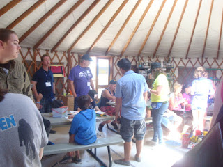
Art time in the camp's yurt.

The camp is set in the Livermore hills.
 You might be more interested in the following video where some of the campers tell you why the camp is so important to them. http://youtu.be/mF2d8kq2GBQ

For every $1,000 raised, a child can go to camp at no cost to the family.

Sunday, August 9, 2015

Training Ride 8/8: Grizzly Peak Cyclists Monthly Ride

GPC has an all-club ride every month on the second Saturday.  We all start together at the Orinda BART station. All routes ride together at a social pace down San Pablo Dam Road to Castro Ranch Road and then break into various groups based on pace and distance.   
Cyclists gathering for the ride.
 Several friends from the arthritis training group wanted to do the 50 mile route, so to get some extra miles in, I rode over to the BART station from home.  That adds about 11.5 miles each way.  

We had a cool start in Orinda, despite temperatures being predicted to be in the mid-80s on that side of the tunnel.  Of course, it was only 9 am.  

We had a group of 8 on the 50 mile route, which is always the same, so the details will be similar to last month's club ride. We went over Pig Farm Hill (not too bad today, probably because it wasn't too hot), down Alhambra Valley Road (wee!) and continued on to Reliez Valley Road.  We took a break at the golf course on Grayson before the climbing.  The temperature was going up, but still pleasant.  
At the top of Pig Farm Hill, looking back toward the climb.

Looking the other direction at the top of Pig Farm Hill.

 We did the climb on Reliez.  It is a bit tricky.  The road is narrow with no shoulder and a honking curb.  It can be a bit unnerving if there is a fair amount of traffic.  Fortunately, as a residential road, the amount if traffic is lighter.  But that's not the tricky part.  The tricky part is that there are several false tops.  You keep thinking you are almost at the top, and then you're not.  I've done it often enough lately to be familiar with its tricks and not be disappointed to find more climbing ahead.  The climb isn't so terribly long, but it is steep.

We continued through Walnut Creek neighborhoods to arrive at Danville Blvd.  Danville Blvd is a very long street that starts in Walnut Creek and continues to Sunol, changing its name a number of times.  It is pretty highly traveled by cars as well as bicycles, but at least the bike lane is wide.  In this direction, it is ever so slightly uphill, but not enough to make a real difference, so you can make some real time here.  And so I did, all the way to Danville Peets. Where we took a lunch break.

Unlike last month, there was plenty of space outside and we could grab a table and chairs under an umbrella and park our bikes in the rack (mostly).  We had a relaxing time.  Temperatures stayed pleasant, perhaps because of a strong breeze. 
Arthritis training group ladies at Peets: (L to R) Kim, me, Mary and Rita

 We returned the way we came through Danville and Walnut Creek.  This time, ever so slightly down hill on Danville Blvd, so you can really go quickly.  After a brief stint on the multi-use trail at the end of Olympic Blvd., we continued into Lafayette to take Happy Valley Road.  The lower part of the road isn't bad at all, but as it gets higher, it becomes more difficult.  Last month was the first time I had been on this road in quite a long time, and didn't remember it well, so I hit the more difficult part in the wrong gear and then barely dragged up it. Lesson learned.  I definitely used a lower gear this time and was much happier.  

We turned off before the hardest part, and went down Sundown Terrace and several other residential roads in Orinda to return to San Pablo Dam Rd and the BART station.
It is good to see this sign.  It means the climbing is done and time to head down hill (wee!) [corner of Sundown Ter. and Happy Valley Rd.]
 From BART Sherrie both headed over Wildcat Drive to return to our homes.  By the time I arrived in Kensington, the wind was really blowing and the temperature was noticeably lower.  

It takes a long time to go 75 miles.  It was good to be home.

Stats:
75.08 miles
4,229 feet of elevation gain


Friday, August 7, 2015

Training ride 8/5: Nicasio-Marshall Loop

This was my last Wednesday ride for the season because I'll be back at work on Wednesdays (and every weekday) from now on.  

We had another large turn out for this ride, which started in Nicasio.  It was a bit cool, but predicted to be 85 degrees in nearby San Rafael later in the day.  We started out on Nicasio Valley Road and then turned east on Pt. Reyes-Petaluma highway (toward Petaluma).  There is a steep but short climb without much shoulder shortly after making the turn. The sun was already out when we reached the climb and it was warming up.  After the downhill, we rolled along and then passed the French Cheese Factory.  I would have liked to stop and taste the cheese, but we had just started the ride.  If you have a chance, it is a nice place to stop and relax.  There is cheese tasting and for purchase, as well as other food items.  The grounds have a picturesque pond with picnic tables around it.  
There isn't much in the Nicasio square: a baseball field, this fire department, the Roadhouse and a church (shown below).


We continued on to Hicks Valley Road, which had more rolling hills.  We saw a group of young deer on the way.  One was very skittish and I was mildly concerned that it would dash in front of us, but it stayed on the side of the road.  Hitting or being hit by a deer can be bad for all involved.  Perhaps you have seen the YouTube video of the mountain biker in a race in Africa getting knocked off his bike by an antelope buck?  If not, you can see it here https://www.youtube.com/watch?v=S2oymHHyV1M.

Once on Hicks, there was very little traffic, which is much more relaxing.  After a short distance, we turned on to Marshall-Petaluma Rd. toward Marshall. There is a lot of nice scenery on this road.  It does some very mild rolling and slight down hill on which you can pick up some speed.  We did have a headwind, but not too bad.   After a very enjoyable few miles in that vein, we climbed for a few miles to reach the top of the Marshall grade, where the fog was in.  There is some great down hill from there just about all the way to highway 1.  The road comes to an abrupt stop at a stop sign just before the highway.  We turn south on highway 1 for just a short distance to the Marshall Store where it was time for a lunch break.  Of course you can get oysters, which all the local places serve, but you should also try their clam chowder.
 
As you can see, they serve oysters at the Marshall Store.  In fact, as you ride along the highway, you can see crushed shells everywhere. 


View from the deck of the Marshall Store.
The sun had come out by the end of our lunch break.  We continued south on highway 1 over some rolling hills and alongside Tomales Bay to Pt. Reyes Station and the Bovine Bakery for another break. During the break at the bakery, I found that there is a bench in the pocket park next to the bakery that was donated by Grizzly Peak Cyclists with our club name on it.  Sadly, its useful life is over, but I hear that we will donate for another bench from the proceeds from the century ride we hosted in May.  

We returned to Nicasio via Platform Bridge Road and Pt. Reyes-Petaluma Hwy. It was a warm return to Nicasio, but not 85 degrees.
The church on Nicasio square.
Stats:
40.94 miles
1,852 feet of elevation gain (but it sure felt like more on the Marshall grade)

Tuesday, August 4, 2015

Mountain Bike Ride 8/4: Big Rock Trail

Today was a short ride to see a trail I have not been on before.  Big Rock Trail departs from a trail head on Lucas Valley Road in San Rafael.  It was warm and sunny when I left my house in the morning, but the weather was grey and cloudy by the time we arrived at the trail (as predicted by the forecast I saw before leaving).  

Although it didn't look the very good at the start weather-wise and it was windy, too, it actually felt quite warm and humid going up the trail.  The trail is mostly a fire road that climbs up.  It goes through and around the Lucas Valley Preserve.  After about 2.5 miles, Redwood Canyon Fire Trail comes in and we continued on that.  At mile 3.6 we reached a peak that had a radio/cell tower.  We stopped there and returned the way we came, but it does continue as Big Rock Ridge Fire Trail.  There was a lot of wind on the ridge with the tower, so we didn't stay too long, even though the view was good.  Having sweated a lot to get there, the wind made us cold.

The grade isn't too steep, there are a few larger rocks, but not much; no real obstacles.  Because it has been some time since there has been any rain, there was some loose dirt and small rocks, but not difficult to manage.

A view from the trail.


View from the ridge.

The trail continues, but we turned around here.
The radio tower.
 
Stats:
7.13 miles
1,472 feet of elevation gain

Training Ride 8/1: Woodside and Los Altos

The arthritis training group met at 8:30 on Canada Road for a ride around Woodside and Los Altos, two upscale communities with lots of quiet, leafy streets.  We had a very large group turn up for this ride, but we quickly broke into several smaller groups.

From Canada Road we headed into Portola Valley (another upscale place) on Portola Road and then over to Alpine and Arastradero and then Purisima Roads.  We skirted Foothill College and went through a number of residential neighborhoods, with large, if not impressive, houses in Los Altos. 


As we were cycling down a road in Los Altos, the sight of this elaborate fountain struck me.  It was a real surprise to me; it seemed like something out of another time period.

We emerged at Foothill Expressway and continued on that to Magdelena where we pulled into the Rancho Shopping Center to stop at one of the restaurants for lunch.  Some headed to the bagel place and others to the bakery. 

After lunch outside in the shade, we returned to Foothill and continued along it at a good clip.  The bike lane is wide and the scenery isn't bad, but there is a lot of traffic driving fast, so not a relaxing area.  We turned on to Sandhill, which is nice enough except for the section where the bike lane is in between the two car lanes as drivers sweep in and out for the various freeway exits and entrances.  The area can be tricky and you've got to be paying attention.  

At the bottom of the hill, we took Manzanita. A quiet and relaxing change from the Sandhill freeway traffic.  When we were almost to the end, Keith got a flat tire.  It gave me a few minutes to stop and check out the chickens.
Keith fixing the flat.

Chickens
Rooster.
 Overall, it was a nice day, not too hot and with a mild breeze and good company.

Stats:
45.51 miles
2,206 feet of elevation gain

Training Ride 7/29: Mt. Tamalpias-Stinson Beach

Temperatures were forecast to be high all over the Bay Area and over 100 degrees in the valleys!  I joined the regular Wednesday ride to go from Mill Valley, out to Stinson Beach via Mt. Tamalpias and return on highway 1.  I was hopeful the time near the coast would have lower temperatures.

The drive over to Marin took much longer than expected.  The Richmond-San Rafael bridge was backed up pretty good and traffic was somewhat congested coming through Larkspur to get on 101 south.  Our meeting time was for 10 am at the Safeway on Miller Avenue.   I was already late when I started looking for a place to park, so I didn't have high expectations that the group would still be at Safeway when I arrived, but I was wrong.  Lots of other people were also delayed and more continued to arrive after me.  The weather was not as warm was I was expecting, given the weather reports, but it did bode well for not over-heating.
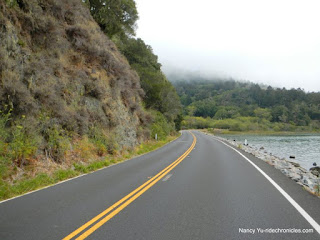
View of Marion Road.  Thanks to Nancy Yu for sharing her great photos.  You can see more of her work at RideChronicles.com
When it seemed like most people who would be coming had arrived, we headed down Miller on our way to Old Mill Park, Cascade Drive and then Marion Avenue to start climbing up.  We went up Marion, Edgewood Avenue, Sequoia Valley Road and then on to the Panoramic Highway. Marion is a lovely narrow street that twists and turns.  There is very little car traffic and plenty of redwood trees and shade.  It is one of my favorite bits of this ride.

As we arrived to Panoramic Hwy the fog was getting pretty thick.  While on the first part of Panoramic there were a number of places where the trees were so damp from fog/drizzle that water fell down from them like rain.  Not at all what I was expecting and I started wondering if I had brought enough clothes to keep warm.  About half way along the highway, however, the sun not only came out, but it began to get hot.

We had a break/regroup listed for the Pan Toll ranger station.  I've never been to the ranger station and didn't even realize that there was one there off to the left of the highway, so I missed the regroup.  Other people obviously knew it, but I followed the directions that said bear right on Pan Toll.  The climb up Pan Toll was pretty hot, but it was clear that there was some significant fog at the beach well below.
Bolinas lagoon as seen from highway 1.  Thanks to Nancy Yu for this photo.

We followed West Ridgecrest Road  and then went down Fairfax-Bolinas Road to Bolinas. I've always taken the road in the other direction (also downhill, initially, to Fairfax).  Now that I have been both ways, I prefer the dam side for fun down hill riding.  Anyway, after about 2 miles of going down hill, we arrived at Highway 1 and turned left (south) to go to Stinson Beach.  Although there was blue sky on the way down to Bolinas, the temperature was dropping and as soon as we headed toward Stinson, the fog returned.  
This sign comes at the end of Fairfax-Bolinas Road on the Bolinas side.  As you can see, the sky is blue.  Trying to find this road from highway 1 can be difficult as all signs posted get removed by residents.  See the Wikipedia post for more about that:  https://en.wikipedia.org/wiki/Bolinas,_California

Seaside themed fence in Stinson Beach.
We had a picnic lunch at the beach.

We had our lunch break at the beach picnic area.  There was quite a lot of people at the beach for a weekday.  Perhaps many were trying to get out of the heat in other places?  Summer vacation in effect?  after the lunch break, we returned  to highway 1 and continued south.  There is some climbing after leaving the beach.  It doesn't look that bad on the elevation profile on the computer, but in real life, it felt like more than what the profile shows.  After the initial climbing, there is some down hill and small rolling hills followed by one last climb after passing Muir Beach.  

View down to the ocean in the fog.  Thanks to Nancy Yu for this photo.

Highway 1 in the fog after leaving Stinson Beach.  Thanks to Nancy Yu for this photo.

The fog was still present, but we were heading inland at that point.  It was great to have cooler temperatures for the climb up.  After reaching the top of the climb and heading down again, the sun came back out and it was basically all down hill to Mill Valley.  The mileage was a little less than I thought it would be, so I did about 5 more miles around Mill Valley before returning to the car and heading home.

Stats:
39.84 miles
3,649 feet of elevation gain

Training Ride 7/28: Old Tunnel Road & Grizzly Peak

It was fairly warm today, so I waited to do a bike ride until late in the day when the temperatures were coming down.  I rode off from home and into Berkeley.  I took the Bike Blvds: Milvia over to Russell, on to Hillegass and then up Woolsey.  I crossed Claremont in Rockridge and headed further up hill on The Uplands (nicely avoids the narrower part of Ashby Ave.), to Tunnel, and then Old Tunnel Road.  

The first part of the climbing on Tunnel and Old Tunnel were exposed and hot, but after that, there was more shade and it was more comfortable.  At Broadway, Old Tunnel becomes Skyline Blvd.  At the top of the climb (at Grizzly Peak and Skyline), I debated what to do, given the time and amount of light left.  I decided to take Grizzly Peak Blvd rather than continue on Skyline to Pinehurst or other destination.  There were some great views on Grizzly Peak.
Looking toward San Francisco.  Pretty clear, but fog was settling in in the City.  Taken from a random spot on Grizzly Peak Blvd.

Another shot toward SF.  Taken from one of the pull outs/viewing spots favored by motorcyclists. 

One of the graffiti-ed logs at the pull out.  If you have driven or biked on Grizzly Peak, you have seen this place.

I continued on Grizzly Peak to the intersection with Spruce.  I headed down Spruce but instead of my usual route home, to add a few more miles, I followed it down to Virginia and then got back on Milvia to return home via Solano and Ashbury.  

At that point, the mileage was still a little low, so I continued past home to Moser Lane and then back home.  Timing was just about right with the sunset, so I didn't need to use the light I had brought

Stats:
25.35 miles
1,964 feet of elevation gain