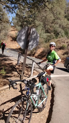
7/29 Ride from Danville up to the summit of Mt. Diablo and back. A small but intrepid group. Temps were warm but there was a cool breeze for much of it. Tons of dragonflies at the summit. My camera is not good enough to get a picture of them, but it was something to see.
 |
| View from the summit |
 |
| Mary A. stretching ballet barre style at the junction. |
8/2 was my final Wednesday ride with Grizzly Peak Cyclists for the summer was to Heart's Desire beach in west Marin. I started in San Rafael, met the group in Nicasio, continued together to the beach. Weather at the beach was lovely.
 |
| Plenty of folks enjoying the beach today. |
We took a group picture after our lunch at the beach.
 |
| It was a big group. I'm in the back with the blue cap on. |
The group returned via a stop at Pt. Reyes Station and the Bovine Bakery, but since I had ice cream the night before and plans to visit a friend in Santa Rosa after the ride, I passed on the bakery and returned via the Olema Hill, through Nicasio and back to San Rafael.
On 8/5 the Arthritis Foundation training group went to the South Bay: Los Gatos to Capitola up Mt. Charlie and back. It started out pretty warm in Los Gatos at 8:30 am, but it was a pleasant ride out from Alma Dam at the Lexington Reservoir to the Old Santa Cruz Highway. After the first 2 miles, it was primarily climbing up to Summit Road. I love the Santa Cruz mountains and today was a gorgeous day.
We had a fast 10 mile down hill into Soquel and break at Gayle's Bakery. The place is famous and has the crowds to prove it. From here, we went through town, into Santa Cruz, along the coast and then headed away from the ocean breezes to Scotts Valley.
 |
| We are on a break before the climb up Mt. Charlie. It was fairly warm, but not too bad, especially in the shade. Fortunately, the climb had quite a bit of shade. |
Mt. Charlie Rd. is named for a real person. A brief summary of his story is at http://www.beal-net.com/hwy17/charlie.html.
 |
| Here we are at the end enjoying some cool beverages and watermelon. |
The ride starts with a 7 mile climb up highway 9/Big Basin Rd. Highway 9 has had a one lane only section controlled by timed signals for the last few years due to road work. It is still there.
 |
| When cyclists get to the light controlling the one lane section, pushing the button will allow for extra time to get to the other side that if there were only cars. |
At the top of the climb, we crossed over Skyline and headed down highway 9 and continued down hill into the town of Boulder Creek. Normally, we would take a more circuitous route along Skyline and Bear Creek Rd. but due to the collapse on Skyline, highway 9 is the only way to Boulder Creek. This shaved off a few miles, but not enough to matter. After getting really sweaty climbing up 9, the ride down the other side felt really chilly as the fog came in in some places and speeds were high. I took a brief break and Boulder Creek to pick up a sandwich for later and then we took Big Basin Rd.
Big Basin Rd. is fairly quiet, mildly winding road that goes all the way to the main entrance of the state park. The main ranger station is a good place to stop for water refills and the restroom. Also a great op location with a giant hollowed out tree right there. Normally, we take a picture there, but not this year as about half the group took the "short cut" back via highway 9 and didn't come this way.
From the park, the road continues similarly with the road getting narrower, only one lane in some places. It is typically fairly quiet on this section but seemed quite busy today. Perhaps people are trying to catch a final weekend getaway before kids start school or maybe it is because Skyline does not go through and people are taking an alternate route. Still a lovely ride.
 |
| At the Big Basin State Park sign as we exit the park. |
After reaching the top of the climb, there is a speedy down hill back to highway 9 and then another climb up highway 9. Although I came down this road in the morning, it had a whole different look slowly climbing up in the afternoon. Often this section up to Skyline is quite hot, but we were blessed with a cool breeze and more shade than I remembered.
Once we crossed over Skyline, it was the big pay off, 7 miles all down hill to the car!
 |
| Group at the end of ride. |

No comments:
Post a Comment