Saturday, September 6, 2014

Day 00: Sept 5

Friday, Sept. 5.

Attempt #2 for this entry.  Isn't technology great?  The photos were preventing me from posting.  Hope to add the photos later.

The bus arrived to take us to Oregon, but not the truck to take the bikes.  We loaded the bikes on to the bus and took off a bit late.

After some phone calls to find out what was going on, arrangements were made to meet with the truck driver where I-5 & 505 meet.  It seems someone misread the location.  We got back on the road again and continued.

We had a break for lunch in Dunsmuir.  We continued on for some time before a rest stop break not too far away from Cottage Grove.

Sadly, shortly after we got on the freeway again there was a terrible back up for quite a few miles.  Traffic crawled along.  Despite all the signs warning of construction, in the end, there was no road work happening, just a closed lane.

The bus ride was scheduled to be 13 hours with an arrival time of 8 pm, but we didn't arrive until 11:15 pm.  I was happy to check in to a hotel and not put up a tent.

Bikes on the bus before the transfer to the truck.

Lunch stop in Dunsmuir.


Sunday, August 31, 2014

Training Ride 8/30: San Rafael-Marshall-Pt. Reyes Station

This was our final group training ride before taking off for the tour.  I was unsure if I should do it because I've had a cold this week.  The cold has been on the mild side, so I decided to go and cut the ride short if I didn't feel well enough.

We met at the end of Lucas Valley Road, which is actually called Smith Ranch Rd. at that part.  I hadn't done this route before.  It was also the last ride of the training season last year, but it was rained out.  However, I have been on all the roads before on various other rides with other people or groups.

Although warm already at 8 am, it was also breezy.  We took off into a head wind down Lucas Valley Road to Nicasio. Although there are some spots with no shoulder, I generally like riding on Lucas Valley Road.  There is a bit of a steep climb in this direction, but it is much gentler on the way back when tired.  After about 11.5 miles we arrive in Nicasio for a regroup.

The group taking the shorter loop went from here to Pt. Reyes Station.  The group taking the longer loop headed the opposite way on Pt. Reyes-Petaluma Rd.  I took the longer loop route, knowing that I could still cut it short if I wanted.  We had a short water stop at the Cheese Factory (Rouge et Noir) and continued to Hicks Valley Road and then on to Marshall-Petaluma Rd (toward Marshall).  These are nice country roads with little traffic.  About 3/4 of the way on the Marshall Rd you climb the Marshall Wall.  There was a nice breeze going, not the head wind we had on Lucas Valley. 

After reaching the top, there is a nice long descent all the way to the stop sign at "T" with highway 1.  Labor Day weekend with nice weather, means lots of people out at the oyster retaurants along the highway, some driving like fools.  In general, the ride on 1 was good and the view was great!

We turned off on Mesa Rd. to wind through a residential area on our way to Pt. Reyes Station.  We stopped for lunch there.  At Leticia's urging we diverged from the route sheet and did not go over to Samuel P. Taylor park but returned via Pt. Reyes-Petaluma Rd, Platform Bridge Rd. and then Nicasio Valley Rd. to get back to Lucas Valley.

Changing the route cut off about 8 miles and maybe 1,000 feet of climbing, but since I was sick, I decided that was fine.  I appreciated the shade on Lucas Valley Road since the temperature had been going up noticeably as we moved away from the coast.

I had a new accessory with me on this ride and the last one, a mirror on the handlebars.  I haven't used any kind of mirror up 'til now.  When I changed to this bike with traditional handlebars from the Bianchi with flat bar, I started thinking that it would be easier to see behind me with a mirror, so I finally got one in preparation for the tour.

John put it on for me in time for last Saturday's ride, unfortunately, it was somewhat loose and it kept slipping out of position, so I spent a lot of time looking at my arm and sometimes my thigh last weekend.  John tightened it up for this weekend, which improved things, but it still moved around on its own.  He'll tighten it up some more and see if we can get it to stay put.


Here is everyone before setting out on the ride.  Thanks to Rita for the picture.

Here's my new mirror.

Lucas Valley Road.  Thanks to Sueli for the picture.

Nicasio Volunteer Fire Department.
Stats:
64.94 miles
2,984 feet of elevation gain

Wednesday, August 27, 2014

Training Ride 8/24: Mountain biking at Redwood and Joaquin Miller parks

On Sunday, 8/24 John and I joined his friend Chris for a mountain bike ride that started in Redwood Regional Park on Skyline in Oakland.  We headed out on West Ridge Trail until we got to the crossing with the Chabot Science Center's parking lot, where we turned down, crossed Skyline and entered Joaquin Miller park. 

Unfortunately, I don't know the name of most of the trails that we take, but I can say that we went down Cinderella.  About halfway down I got indecisive about what line to take down a technical part and ended up on the ground with some scrapes.  It was a minor fall.  Most of the time my falls are preceeded by indecision.

I could feel the effects of the ride from the day before.  I didn't have any power in my legs for uphill obstacles on the trail, but my goal was not to have a great technical ride, just to get some more miles in with cardio.  Also, remember, that I count mountain biking miles double road miles.

The parks were about the most crowded that I can remember ever seeing them, especially since this was a regular Sunday and not a holiday.

Eventually, we worked our way back to Redwood.  We did a hot climb up Canyon Trail.  It has been a long time since I've been on this trail and I had forgotten how steep it is.  I tried to figure out what the elevation gain was just for this trail, but I couldn't do it.  It appears from the park trail map that it is only 0.36 of a mile, but it felt like more.  Trail map: http://www.ebparks.org/parks/redwood#trailmap.

After that, there are rolling hills all the way back to the parking lot on East Ridge Trail.  Some of these are tough, too, especially after Canyon, but not nearly as difficult.

View from the top of one of the rolling hills on East Ridge Trail.

Also East Ridge scenery.

Here's my scrapes.  Unpleasant, but no big deal.
Stats:
12.30 actual miles (not double)
1,697 feet of elevation gain

Training Ride 8/23: Big Basin

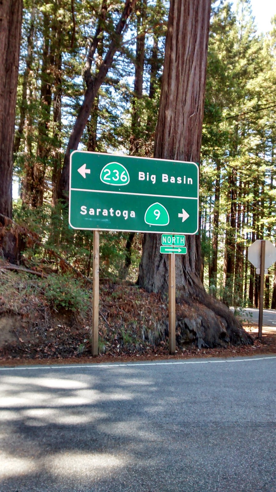
On Saturday 8/23, the Arthritis Foundation training group met in Saratoga for a challenging ride.  We started in downtown Saratoga on 4th Street.  One group headed up Big Basin Highway (also known as highway 9) for a 7 mile climb (about 2,170 feet) to Skyline Blvd. (highway 35).  Another group went by car up to Skyline to create a shorter loop with less climbing.  Both groups continued separately on Skyline for about 10 miles with rolling hills and a winding descent.

We turned right on to Bear Creek Road and followed that for about 9 miles, mostly down hill but with a few rollers thrown in, back to highway 9 in Boulder Creek.  Both groups met here for lunch.  The group on the shorter loop got back on highway 9 and continued all the way back to Skyline.  The group on the longer loop took a few back roads to get on to Big Basin Highway.  We climbed another approximately 1,000 feet over about 9 miles to arrive at the visitor center at Big Basin State Park.  The park is beautiful with some wonderful redwoods.  There were also plenty of pine trees; I could smell them throughout the afternoon.

The day was warm, but there was lots of shade as we continued up Big Basin Highway to the summit.  The road gets pretty narrow at times and we did encounter a driver who just couldn't wait another 30 seconds and had to pass us on a blind curve while we were descending.  There was another car coming around from the other direction, but fortunately there was no collision.  At the end of Big Basin Highway we returned to highway 9 to climb up to Skyline Blvd.

Although it was a beautiful ride, there was a lot of climbing, so I was happy to reach Skyline.  After crossing Skyline everything is downhill!  The seven curving miles down to the starting point are great fun to descend and luckily, perhaps due to the road construction, there was very little car traffic around me.


Group picture at the start of the ride.  Thanks to Rita for the picture.


Getting ready to get back on the road after lunch.
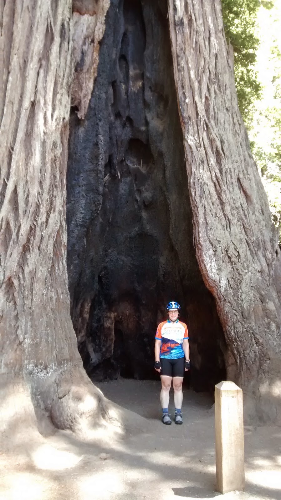
Here I am in front of one of the VERY large trees at Big Basin State park.
This picture will give a sense of the scale of the trees.  Can you see the woman standing at the tree's base?
Almost there...getting ready to get back on highway 9.

 Stats:
57.65 miles
elevation gain, take your pick:
8/23 reading: 7,506 feet
2013 reading: 6,089 feet
amount printed on cue sheet: 6,280 feet

Sunday, August 24, 2014

Training Ride 8/20: Berkeley Hills

Another evening ride, part of the Arthritis Foundation's training schedule.  Tonight, it was just me and Mary, the ride leader.  Mary is recovering from a mild knee injury, so we kept the mileage down.  We left from the usual site at Peet's Coffee at College and Alcatraz.  From there, we wound through the Rockridge streets to arrive at Tunnel Road.  The section where the bike lane moves to the left of the highway 13 traffic can be a bit dicey to negotiate, but tonight one of the cars made room for me.  A cyclist behind the wheel? 

We made the left turn and headed up Old Tunnel Road.  At the top, we kept on rolling up Grizzly Peak Blvd.  There was a lot of fog blowing around and condensation was dripping off the trees.  We made a stop at the steam trains parking lot to put on more layers and turn on our lights.  I was so happy to have packed the full-fingered gloves as well as arm and leg warmers.  We had a quick chat with a couple of mountain bikers, also putting on layers, about when the old Berkeley Bowl supermarket opened.  When was that?

We returned to the road and then headed down Golf Club Road by the Tilden park golf course to get over to Wildcat Drive.  We continued down to San Pablo Dam Road and went east to the Orinda BART station. My hands were freezing after so much descending.

We rode BART back one stop to Rockridge.  From there I rode my bike back to the car a few blocks away.  I warmed up a little on BART, but by the time we were back in Oakland my fingers were numb again.  I was envisioning having a cup of hot chocolate when I got home. 

Only in the Bay Area could it be so cold in August.

A foggy night in Berkeley.  It was blowing in in drifts.  This picture doesn't do it justice.
Stats:
19.82 miles
2,257 feet of elevation gain

Tuesday, August 19, 2014

Training Ride 8/17: GPC Mid-August Birthday Ride

On Sunday, 8/17, my training ride was a Grizzly Peak Cyclist club ride celebrating a couple of August birthdays, Sherie and Kurt.  Sherie is the club president.  She also selected the route.

We started in Half Moon Bay with overcast skies and drizzle.  I had the arm and leg warmers on.  The first ~20 miles were heading south on highway 1 to the Pigeon Point Lighthouse.  There were some very large rollers on the way.  We regrouped at the lighthouse and then continued on a little way further on highway 1 before turning onto Gazos Creek Rd.  We headed up a spur that passed some lovely territory.  It ended at a gate with a dirt road on the other side.  It was definitely time for me to take off the arm and leg warmers by that time.  We returned, headed up Cloverdale and rode for a while before turning on Butano Cutoff and then over to Pescadero for lunch at Arcangeli's.

Arcangeli's grocery is the home of the very tasty garlic and artichoke bread.  They bake it fresh throughout the day.  In addition to a sandwich for lunch, I got a loaf of the famous bread.  I have a large bike bag and was able to cram one of smaller loaves in there.  Probably that bag will smell like garlic for some time to come.  Thanks to Phil who passed around a delicious olallieberry pie, still warm from the oven at a place across the street, to all interested Grizzlies around the picnic tables.  Some people said it was better than Fat Apple's pie.  I think I'll have to have a slice of theirs to adequately reach a conclusion.

After lunch was Stage Road.  It starts out all sweet and friendly, with new pavement, but the new pavement ends and the rolling hills and then climbing come in.  At the top of Stage, we went north on highway 1 a short distance to get to Tunitas Creek Road.  We had a break at the Bike Hut and then moved on.

Unfortunately, I misinterpreted the cue sheet and turned left on Lobitos Creek Cutoff instead of Lobitos Creek Rd.  It only cut off about 5 miles but quite a few feet of climbing.  Here's how Sherie described it: "The climb up to the farms on the ridge-line offers a challenging but peaceful gradient, spectacular views all around the hillsides and back out to the ocean...(think something like somewhere between Tunitas Creek, Old La Honda Road and the top of Coleman Valley Road)...and then a zippy, fun descent down to where it joins Verde Road.... about as fun as a bicycle ride can get!!"  Oh well, next time.

Lobitos Creek Cutoff did rejoin the route without any difficulty.  We continued on Verde Rd., Purisima Creek Rd., and then a climb near the end on Higgins Canyon Rd.  After the climb, there was a nice descent and we were back by the firehouse on Main Street in Half Moon Bay.

Pigeon Point Lighthouse.

End of Gazos Creek Road.

Not the best picture, but the best I could do to show the picnic area at Arcangeli's.  This was after we sang Happy Birthday.
Flowers at the Bike Hut.
 Stats:
61.05 miles
3,761 feet of elevation gain
1 loaf of bread, mildly flattened, but still gooood.


Sunday, August 17, 2014

Training Ride 8/16: Peninsula with Sueli

I decided to do a shorter ride today because I'll be doing a longer ride with a fair amount of climbing on Sunday.  I met a friend from the Arthrtis Foundation training group, Sueli, and did one of her standard routes.  We left Canada Road near highway 92 and headed all the way down it and into Woodside.  We continued into Portola Valley.  From there we headed up Alpine for a climb and then returned the way we came.

On Canada road, we happened to meet up with another Arthritis Foundation training group member, Leticia.  She was also doing a short ride as a warm up to the metric century she would do on Sunday, Tour of Napa Valley.


Leticia, me and Rick at a short rest stop.  Sueli is taking the picture.

Pao de queijo, Brazilian cheese bread baked fresh by Sueli.  We had these with our lunch after the ride.
Stats:
31.54 miles
1,519 feet of elevation